
Blog de la ferme de rendu
Bienvenue sur le blog de Render Farm ! Rejoignez-nous pour plonger dans le monde de la 3D, en couvrant les perspectives de l'industrie, des histoires de réalisation en profondeur, des conseils d'experts, des offres spéciales et nos caractéristiques exclusives de RebusArt. Restez inspiré et repoussez les limites du rendu avec nous !
RebusArt featuring Reza Eftekhari
mercredi 15 juillet 2026 by Nicole Holt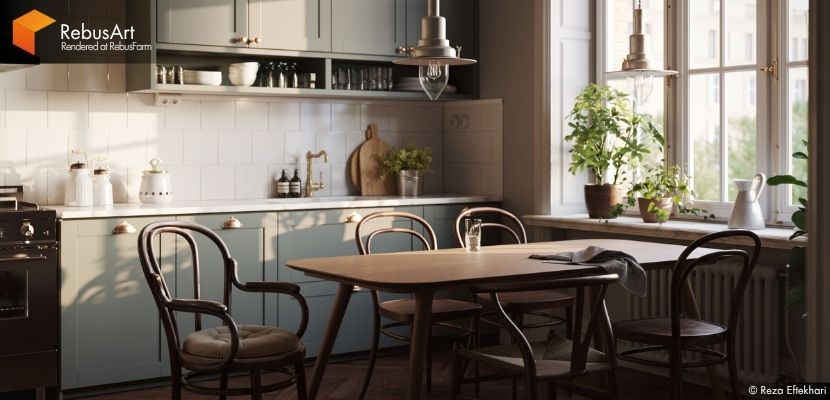
Some artists leave a lasting impression, and Reza Eftekhari is certainly one of them. Known for his thoughtful approach to architectural visualization and his ability to create spaces that feel both cinematic and authentic, Reza continues to push his craft forward while embracing new technologies and creative workflows. We are delighted to welcome him back to RebusArt and take another look at his artistic journey, his evolving perspective on archviz, and the ideas behind his personal project, Scandinavian Kitchen.
Smear Frames in Animation: How Animators Create Fast and Dynamic Motion
mardi 14 juillet 2026 by Nicole Holt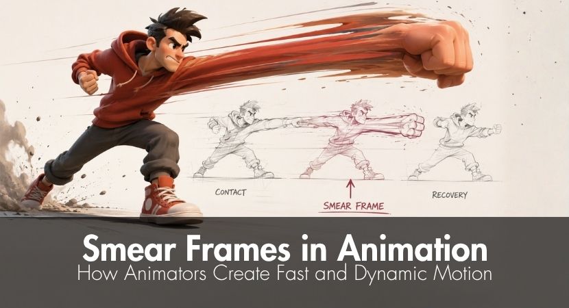
Animation is all about bringing still images to life, piecing frame after frame together to build the illusion of movement. While the concept sounds simple, creating believable motion requires careful control of timing, spacing, and transitions so that every action feels smooth and natural.
One of the common challenges both beginners and professionals face? Fast and dynamic movement.
One of the most effective techniques is smear frames. By briefly stretching or multiplying the appearance of a moving object between key poses, smear frames create the illusion of continuous motion while keeping the action clear to the viewer.
This technique is used in both 2D and 3D animation. After reading through this guide, you'll know what smear frames are, their importance, the best time to use them, when not to, practical tips, and more.
What Is a T-Pose in 3D Animation and Why It’s Still Used
mercredi 10 juin 2026 by Nicole Holt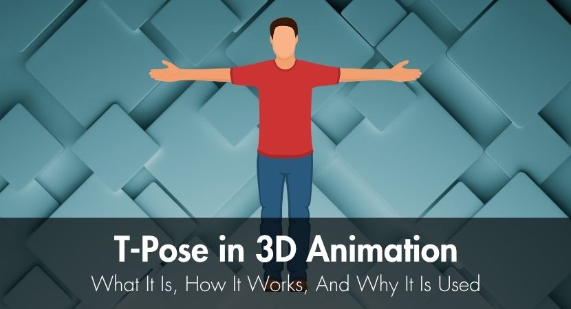
In 3D animation, a T-pose refers to a "esting stance" of a character model where it stands upright, both arms raised to the side parallel to the shoulders, forming a "T". It has been the standard since the 90s until today, as it makes character modeling and animation more efficient.
In this guide, we'll discuss what the T-pose is, how it helps with modeling and animation, and why it's still being used today.
RebusArt featuring Simon von Broich
mercredi 3 juin 2026 by Nicole Holt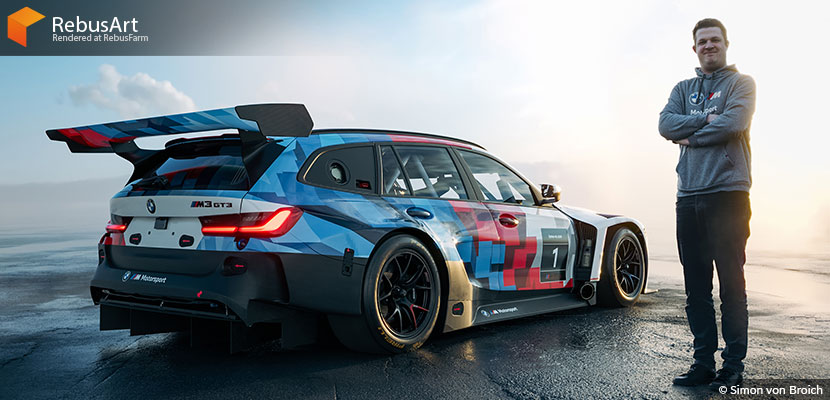
From automotive campaign photography to hyperrealistic CGI, Simon von Broich has built a unique creative path shaped by passion, adaptability, and technical precision. In this interview, he shares insights into his workflow and the story behind the viral BMW M3 Touring 24H project that evolved from an April Fools' concept into a real Nürburgring race car. Discover how Simon approaches photorealism, why community played such a major role in the project's success, and how powerful rendering workflows help bring ambitious automotive visuals to life.
20 Years RebusFarm
mercredi 15 avril 2026 by Nicole Holt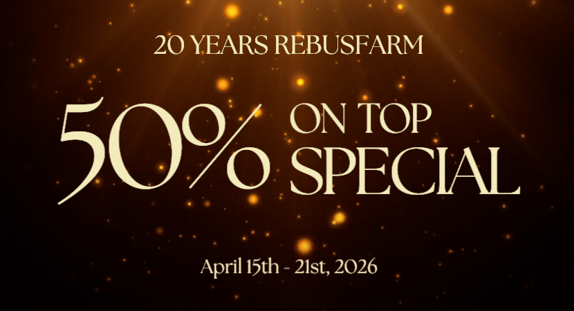
RebusFarm celebrates its 20th Anniversary with a Special Deal for you!
RebusArt featuring Tina Tajaddod
mardi 14 avril 2026 by Nicole Holt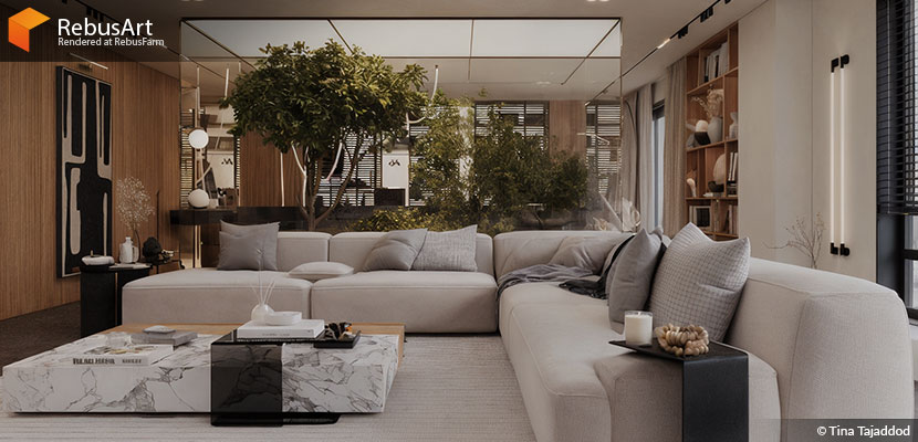
Some artists chase technical perfection. Others build everything around mood. Tina Tajaddod moves confidently between both, shaping a visual language that feels precise yet deeply atmospheric and continues to evolve with every project.
We are excited to reconnect with Tina Tajaddod and dive into her world once again. In this interview, she shares her approach to warm minimalism and the ideas behind her latest project, Elysian Residence. From changing industry expectations to very hands on workflow choices, she offers a clear and honest look at what it takes to create spaces that do not just look real, but feel genuinely alive.
Onion Skinning In Animation: What It Is, How It Works, And Why Animators Use It
jeudi 2 avril 2026 by Vasilis Koutlis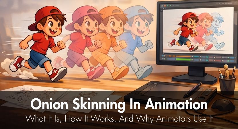
Every animator has experienced that moment of uncertainty when they lift their stylus and question whether their current drawing truly flows from their previous one. Does the arm extend too far forward? Is the spacing incorrect? That's why onion skinning exists. You've come to the right place if you've ever wondered what this method is and how to apply it effectively across various animation styles and tools.
The Making of "Dunes' Whisper" by Ahmed Abd El Mohsen & Khaled Awad
mardi 31 mars 2026 by Ahmed Abd El Mohsen & Khaled Awad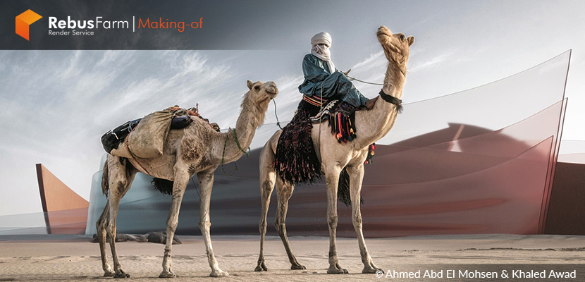
A visionary architectural concept project created by Ahmed Abd El Mohsen and Khaled Awad, architectural visualizers based in Dubai, United Arab Emirates. The design explores the poetic interaction between desert landscapes and contemporary architectural forms, creating a dynamic vision that speaks both to nature and innovation. Let's take a closer look at how this atmospheric visual narrative came together from concept to final image!
ISO 27001 Certified Render Farm: Why Security Matters for Your 3D Projects
jeudi 26 mars 2026 by Nicole Holt
Most 3D artists think about render speed, pricing, and scalability first. Security often comes later, if at all. The moment your project leaves your workstation and moves into the cloud, you are no longer just managing performance, you are trusting someone else with your assets. Whether it is an unreleased product, a client animation under NDA, or a full production pipeline, your files carry real value. This is exactly where ISO 27001 comes in, as a globally recognized standard that defines how professional data security is structured, managed, and continuously improved in modern rendering workflows.